I have made several visits in the past week to Paris Rive Gauche, an area not to be confused with the older part of town traditionally referred to as the Left Bank. Rive Gauche is a massive urban redevelopment project occupying the 13th arrondissement along the banks of the Seine, in a former industrial zone cut off from the city by the railroad tracks of the Gare d'Austerlitz.

Having fallen largely into abandonment by the 1980s, the area became the focus of a large urban rewewal effort led by a semi-municipal authority called SEMAPA (Société d'économie mixte d'aménagement de Paris), which sought to reconnect the 13th arrondissement to its riverfront via the creation of an entirely new city neighborhood. The area is best known as the site of the Bibliothèque François Mitterrand, the gargantuan central branch of the national library system, opened in 1996.

Enormous and controversial as the library complex is, it is actually the other parts of the quarter that have been of particular interest to me. Upon descending from the seemingly endless wooden terrace of the library complex, one finds streets of a scale very similar to that of Paris' older neighborhoods, apart from their apparent grid layout.

Quite unlike the rest of Paris however, the vast majority of buildings in the area was built within the past decade, creating perhaps the highest concentration of contemporary architecture to be found in the city. A continuous work in progress, Rive Gauche has served as a playground for some of France's most reknown contemporary architects, working from an eclectic palette of styles.

Equally fascinating is the enormous diversity of uses to be found here. Rive Gauche is already home to classroom and administrative buildings of several universities, numerous residential buildings, commercial and government offices, and a large MK2 cinema complex. It's a great example of a truly mixed-use neighborhood that has come out of a comprehensive and well-executed plan on the part of SEMAPA.

Work continues on removing the physical barrier presented by the railroad tracks, which still separates Rive Gauche from older neighborhoods to the west. A portion of the tracks has already been built over, and more elevated buildings are currently under construction above them.

The development of Paris Rive Gauche should provide important insight and inspiration for planners working on Philadelphia's Delaware waterfront plan. The initial problem, reconnecting the postindustrial city to its river, is the same. Granted, I-95 and its interchanges present a much greater barrier than a set of railroad tracks. Nonetheless, there is clear proof that the creation of a successful city neighborhood can be done with the right public investment.

Most importantly, Rive Gauche owes its success to crucial parternships between planners, government and educational institutions, and private developers. Nearly all institutions, public and private, seek to expand or find new digs at one point or another. Just imagine the momentum that Philadelphia's waterfront plan would gain if one of its ever-growing universities, Penn, Drexel, or Temple, took a stake in waterfront property. This kind of development is nothing new to Philadelphia - Independence Mall was created by a similarly far-reaching enterprise that created Rohm and Haas' headquarters, the James A. Byrne federal courthouse, and US Mint building, among others.
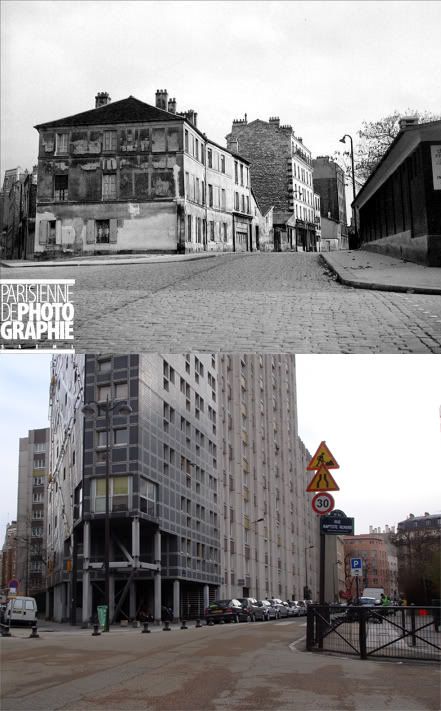
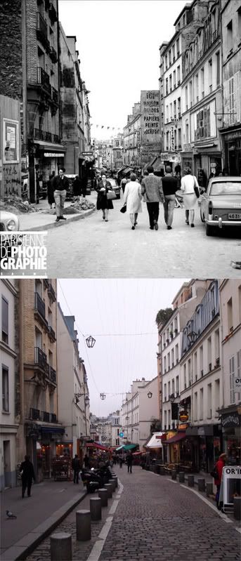
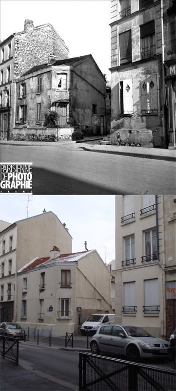
 c. 1910-2009
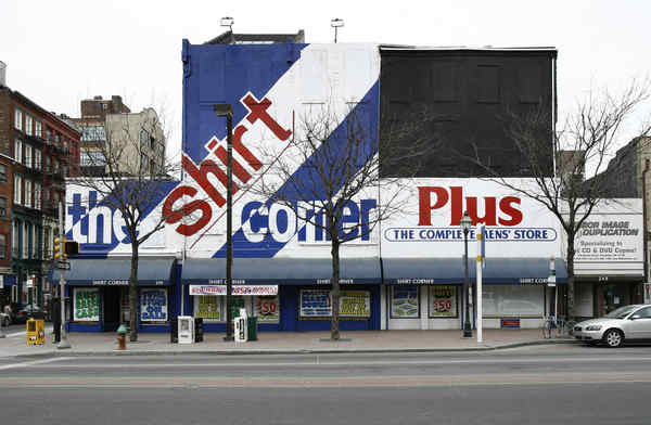


