 1915-2010
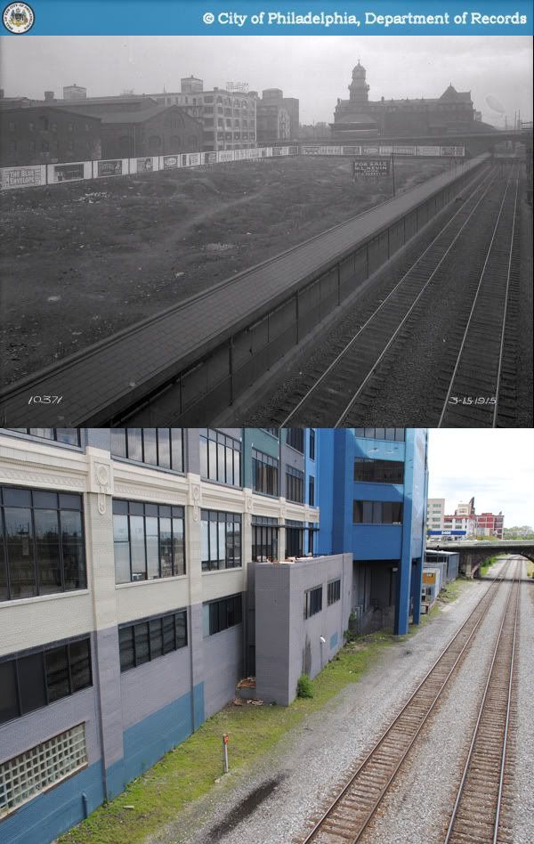
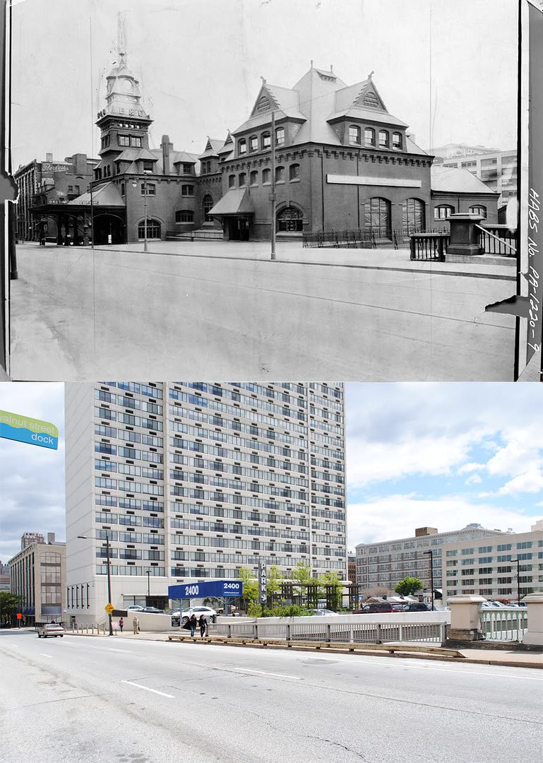
The building on Market Street by the Schuylkill banks that today houses the Marketplace Design Center was initially built as an automobile factory, circa 1920. Like many industrial buildings of its age, it had a loading dock on the ground level connected to the Baltimore & Ohio Railroad tracks by a short rail siding. Also visible in the top right of the original photograph is the B&O's passenger terminal at Chestnut Street.
Before the auto factory, this site was occupied a portion of the city's oldest municipal gas works complex, which straddled both sides of Market Street on the Schuylkill River's east bank for most of the 19th century. The facilities between Market and Chestnut Street were demolished around the turn of the century, at which point something very different may have taken its place.
 In the 1910s, the empty plot was one of several locations under consideration by the City of Philadelphia for the construction of a much-desired convention hall. The primary advantage of the site was surely not its waterfront locale, but rather its easy accessibility to the growing business district west of Broad Street. Nonetheless, the proposal was discarded by the city in favor of a site on the Parkway, and the riverbank plot was turned to private ownership. As an aside, the Parkway project never got off the ground, and it was not until 1931 that the arduous convention hall saga came to an end with the completion of the Municipal Auditorium in University City.
(For a detailed account of the perenially sidetracked convention hall project, I highly recommend Sarah Zurier's thesis at the link below)
Source: Zurier, Sarah Elisabeth. "Commerce, Ceremony, Community: Philadelphia's Convention Hall in Context." MS Thesis University of Pennsylvania, 1997. Internet Archive. 8 Jun. 2010. http://www.archive.org/details/commerceceremony00zuri.
Original photographs:
1. "Public Works-10371-0." 1915. Philadelphia City Archives. PhillyHistory.org. Philadelphia Department of Records. 8 Jun. 2010. http://www.phillyhistory.org/PhotoArchive/MediaStream.ashx?mediaId=33593.
2. "Public Works-10703-0." 1915. Philadelphia City Archives. PhillyHistory.org. Philadelphia Department of Records. 8 Jun. 2010. http://www.phillyhistory.org/PhotoArchive/MediaStream.ashx?mediaId=33703.
Before the auto factory, this site was occupied a portion of the city's oldest municipal gas works complex, which straddled both sides of Market Street on the Schuylkill River's east bank for most of the 19th century. The facilities between Market and Chestnut Street were demolished around the turn of the century, at which point something very different may have taken its place.
(For a detailed account of the perenially sidetracked convention hall project, I highly recommend Sarah Zurier's thesis at the link below)
Source: Zurier, Sarah Elisabeth. "Commerce, Ceremony, Community: Philadelphia's Convention Hall in Context." MS Thesis University of Pennsylvania, 1997. Internet Archive. 8 Jun. 2010. http://www.archive.org/details/commerceceremony00zuri.
Original photographs:
1. "Public Works-10371-0." 1915. Philadelphia City Archives. PhillyHistory.org. Philadelphia Department of Records. 8 Jun. 2010. http://www.phillyhistory.org/PhotoArchive/MediaStream.ashx?mediaId=33593.
2. "Public Works-10703-0." 1915. Philadelphia City Archives. PhillyHistory.org. Philadelphia Department of Records. 8 Jun. 2010. http://www.phillyhistory.org/PhotoArchive/MediaStream.ashx?mediaId=33703.

