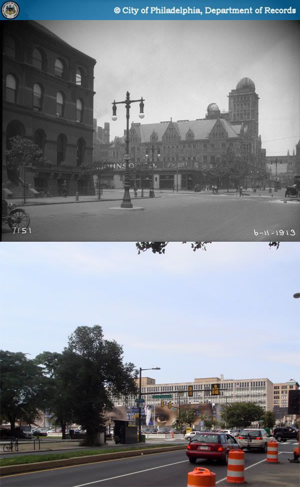
 1913-2009
The southwest corner of Broad and Spring Garden (photo left) had become a gas station by the early 40s, before being replaced in 1958 by the State Office Building and plaza. Central High School on the center right (which will hopefully have its own post soon) was succeeded by the decidedly less inspiring Benjamin Franklin High School, also completed in 1958.
Sources:
1. Philadelphia Architects and Buildings
2. "Philadelphia Land Use Map, 1942." Library Company of Philadelphia. Philadelphia Geohistory Network. Athenaeum of Philadelphia.
Original Photo: "Public Works-7151-0." 1913. Philadelphia City Archives. PhillyHistory.org. Philadelphia Department of Records. 6 Aug. 2009. http://www.phillyhistory.org/PhotoArchive/MediaStream.ashx?mediaId=19917
No comments:
Post a Comment