 1915-2009
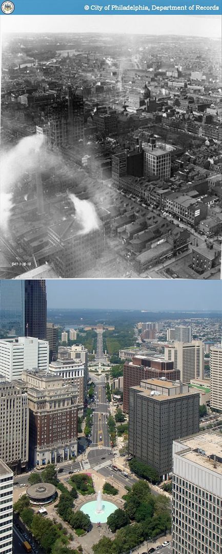
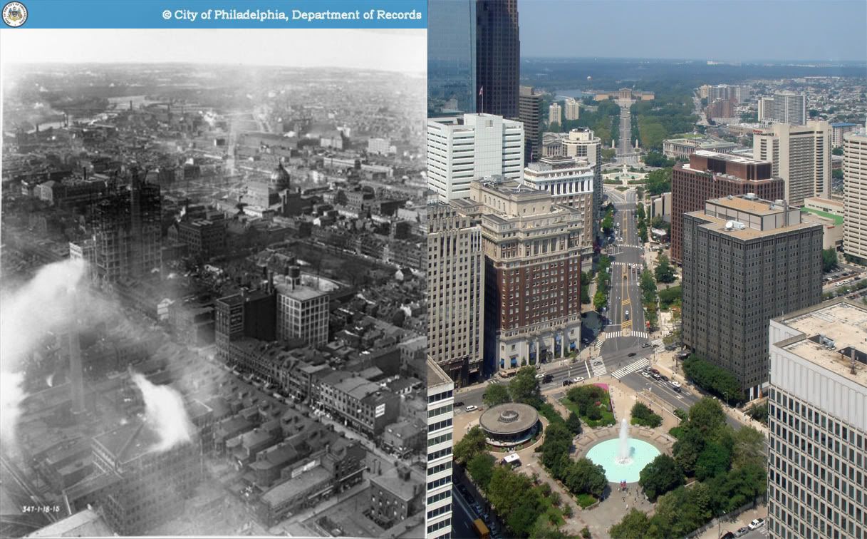
One of the true gems to be found on PhillyHistory.org is a small series of photos taken in 1915 from City Hall tower's observation deck. Roughly 500 feet above ground, it remains the city's tallest observation area open to the public, and its location at the heart of Center City lends it the most magnificent view of central Philadelphia.
Although the city has changed significantly in every direction, no view is as radically different as the perspective towards what is now the Benjamin Franklin Parkway. In 1915, the Parkway was barely in its infancy; demolition for the new right-of-way had begun on the site of the former Fairmount Reservoir, and was making its way toward City Hall. The original photograph gives a powerful sense of the sheer enormity of the project, of planners and civic leaders who dreamed of nothing less than the complete reshaping of the American city. This great ambition was on a scale truly befitting a rapidly emerging, daring, and somewhat brash new nation. Indeed, wholesale demolition and reconstruction of existing urban areas these days seems to be the sole province of places like China and Dubai.
The old photograph also provides a quick glimpse of a Logan Square neighborhood which we would not recognize today, one with a rich mix of row houses, factories, and warehouses. Most of that was quickly redeveloped after the creation of the Parkway and the later replacement of Broad Street Station and its railway viaduct in the 50s.
A horizontally aligned comparison shot can also be found here.
Original photo: "Department of City Transit-347-0." 1915. Philadelphia City Archives. PhillyHistory.org. Philadelphia Department of Records. 17 Aug. 2009. http://www.phillyhistory.org/PhotoArchive/MediaStream.ashx?mediaId=56023
No comments:
Post a Comment